Overview
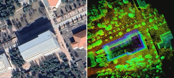
This project is a lightweight 3D mapping payload for the DJI Matrice M350 RTK drone. It lets the drone build an accurate map of an outdoor area without relying on GPS, which matters around tall buildings where satellite signals become unreliable.
A LiDAR scanner and a small NVIDIA Jetson Orin NX computer ride on the drone. Instead of adding another motion sensor, the system reuses the drone's own built-in IMU, which keeps the payload cheaper, lighter and simpler to build. The whole mapping process runs onboard using ROS 2.
What the project is about
Drones often rely on GPS to know where they are, but near large buildings the signal degrades or disappears. This project gives a drone another way to understand its surroundings: it scans the environment with a LiDAR and builds a 3D map while it flies, with no help from satellites.
The payload
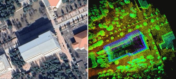
The payload is built around a Velodyne VLP-16 LiDAR and an NVIDIA Jetson Orin NX computer, mounted on a DJI Matrice M350 RTK. Power and communication circuits were designed so the whole unit runs from the drone and talks to it over its E-Port.
How it works
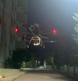
- Sensing: the LiDAR scans the surroundings while the drone's built-in IMU reports how it is moving.
- Computing: the Jetson Orin NX combines both streams with the RKO-LIO method to track the drone and grow the 3D map in real time.
- Simplicity: because the drone's own IMU is used, there is no extra sensor to buy, mount or calibrate.
Flying and mapping
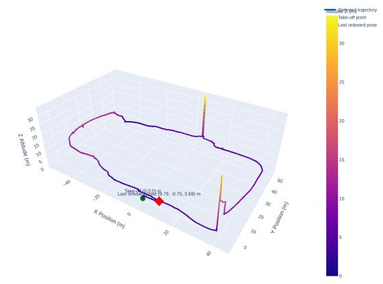
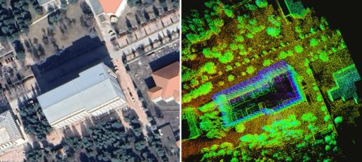
The system was flown around a university building with trees, parked cars and complex facades. The drone climbed, circled and landed while the map was being built onboard.
Checking the map
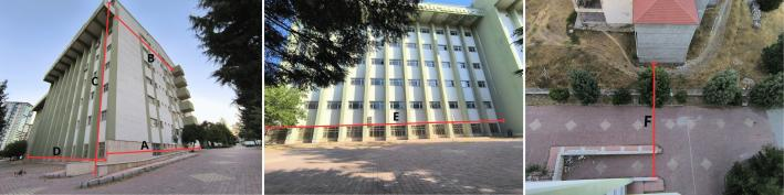
To see whether the map can be trusted, several real building walls were measured on site with laser rangefinders and compared with the same distances in the 3D map. They agreed closely, which shows the map keeps the true proportions of the buildings.
What the work covers
- Hardware integration of the drone, computer and LiDAR, including power and communication circuits.
- The ROS 2 software stack that connects the sensors to the mapping method.
- A field flight test and evaluation of how the mapping method behaves on a drone.
The measurements, tables and extra figures from this work are in the research paper, summarised on the publication page.